
Original article: Un 19,9% de la superficie de Chile es bosque nativo: MapBiomas liberó 25 años de cambios del suelo con datos abiertos y en alta resolución
The MapBiomas initiative, a collaborative effort involving scholars from the Universities of Chile, Concepción, and La Frontera, has published the findings from its ‘Collection 2.0 of annual land cover and usage maps’ for the period 1999-2024.
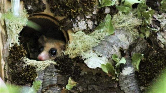
According to the results, 19.9% of Chile’s surface area is classified as native forest, representing nearly 15 million hectares (Mha). The data shows a positive trend: over the last 25 years (1999-2024), native forest experienced a net gain of 240,000 ha (1.6%). In contrast, forestry plantations occupy 4% of the territory, covering approximately 3 million hectares.
Furthermore, the analysis of land coverage highlights significant geographical and ecological differences across the country, from the arid landscapes in the north to the dense forests in the south.
Satellite Images
This initiative emerged from collaboration among specialists in geospatial analysis, remote sensing, geographic information systems (GIS), and programming. Utilizing Landsat satellite images from NASA, cloud processing, and AI classifiers operated on the Google Earth Engine platform, the project has established a long-term strategic partnership with Google to accomplish its mission.
In this context, the collected data allows for a clear understanding of the extent of arid and high-altitude environments, evidenced by the figures indicating that 28.5% of Chile’s total area consists of barren land. This area amounts to nearly 27 Mha, comparable to twice the size of the Magallanes Region.
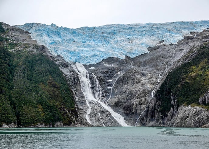
In Patagonia, 84% of the nation’s ice and snow is concentrated, which has recorded a decrease over time.
«MapBiomas Chile is a platform that illustrates how the country’s landscapes have shifted over the past 25 years using satellite imagery. It allows users to track the evolution of forests, agricultural areas, pastures, wetlands, urban areas, and regions of barren land year by year,» explained Adison Altamirano, dean of the Faculty of Agricultural Sciences and Environment at the University of La Frontera.
«Its primary value lies in providing open and updated information to support decisions regarding water management, ecosystem conservation, and sustainable development,» added the researcher.
Jaime Hernández, the general coordinator of MapBiomas Chile and an academic from the University of Chile, emphasized that «the updated platform is entirely new and state-of-the-art, operating under Google Earth Engine. It represents a significant technological leap that has not existed in the country until now. Users will be able to define and conduct their own analyses, download results, maps, and data tables, create multi-temporal GIFs, and more.»
«For the first time, local governments, municipalities, and protected area managers have a tool capable of supporting data-driven decisions about their territories. It is intuitive, powerful, and contains scientific insights in every pixel. It represents a leap into the world’s top tier of Earth observation data available to non-experts in remote sensing or geospatial analysis,» stated Professor Jaime Hernández.
About MapBiomas Chile
Since its inception in Brazil in 2015, MapBiomas has established itself in South American countries and has expanded to Indonesia, India, the Democratic Republic of the Congo, and Mexico, among others.
In 2022, institutions from Chile joined the initiative, leading to the establishment of the MapBiomas Chile Network, composed of experts from the University of Chile, University of Concepción, and University of La Frontera. In all territories where a MapBiomas initiative is present, the aim is not to replace data sources or official monitoring platforms, but to complement them.
Both the generated data and the adapted coding for its processing, as well as the methodology, will be freely accessible. They offer an independent tool, backed by academia, contributing to nature conservation, land planning, water resource monitoring, agriculture, and other sectors.
This initiative also presents a unique opportunity to better understand land use and coverage dynamics more efficiently and updated. «MapBiomas proposes that this can be achieved through the use of cloud processing capabilities, freely accessible satellite data, and high automation of processes, with active participation from the expert community,» the initiative noted.
All maps and relevant information can be found at chile.mapbiomas.org. A summary of the key results is also available in this document.
El Ciudadano
Hazte socio 👍
Con tu donación aportas a la sostenibilidad económica y existencia de este medio.
Elige cómo quieres aportar a la existencia y financiamiento colectivo de este medio!
 Reveniu
Relacionados


Family Calls for Nationwide Mobilization on November 8 to Remember Julia Chuñil's Disappearance
Hace 4 días
Un 19,9% de la superficie de Chile es bosque nativo: MapBiomas liberó 25 años de cambios del suelo con datos abiertos y en alta resolución
Hace 55 segundos
At FAO in Rome, Chile's President Boric Accuses Netanyahu of Using Hunger as a Weapon in Gaza
Hace 1 semana


